| Restocking Fee | No |
|---|---|
| Return shipping will be paid by | Buyer |
| All returns accepted | Returns Accepted |
| Item must be returned within | 30 Days |
| Refund will be given as | Money Back |
| Country/Region of Manufacture | United States |
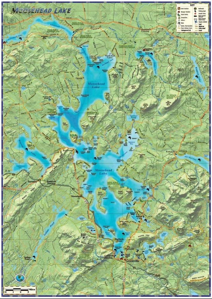
Check the listing for details. Moosehead Lake Maine Wall Map. Condition: New. Listed at 19.99 USD. A beautiful and detailed map of Maine’s largest lake. Features dramatic shaded relief. Shows highways, main roads, minor roads, unimproved roads and trails, town and place names. Locates gates, ranger stations, boat ramps, state parks, reserves, campsites, fishing hot spots, hiking trails and more. Coverage includes Seboomook, Ragged and Brassua Lakes, Indian and Wilson Ponds. Scale approx. 1:40,000 or 1 inch = .6 miles.18.5” x 26”, laminated with edge seal. Ships rolled.
You may also like
$15.98

StreetSmart Los Angeles Map by VanDam Laminated pocket size City Street
$37.95

Helikon-Tex Map Case Roamer Cordura Cover Patrol Accessories PL Woodland Camo
$9

US EAST COAST ~ Lot of Road Maps ~ Pennsylvania to Florida
$24

ILLINOIS TOLLWAY SPEED RADAR TIMED VINTAGE 4 MAPS
$3.97

Royal Gorge Region Colorado 2019 Official Vacation Travel Guide **Nice**
$4

PENNSYLVANIA ~ 1989 Official Highway Map
$15.96

Vintage 1978 Tongass National Forest Alaska Map, US Dept Agriculture (55" x 41")
$99

Vintage United States US Mid Century wall map - Weber Costello- Christmas Gift
$8

Vtg *Lot of 8*Trails Illustrated Topo Maps Colorado Utah Breckenridge Telluride+
$28.95

NOAA Carquinez Strait Suisun Bay Benicia California Nautical Paper Chart 18657
$10

USGS Topo Map -7.5 minute series - Fairfield Quadrangle
$45
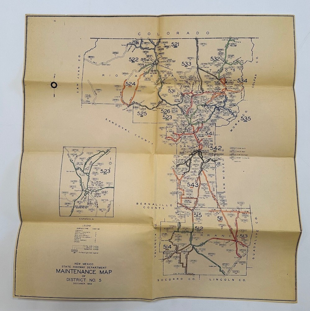
New Mexico Maintenance Map for District 5. 1953.