| All returns accepted | ReturnsNotAccepted |
|---|---|
| Country/Region of Manufacture | United States |
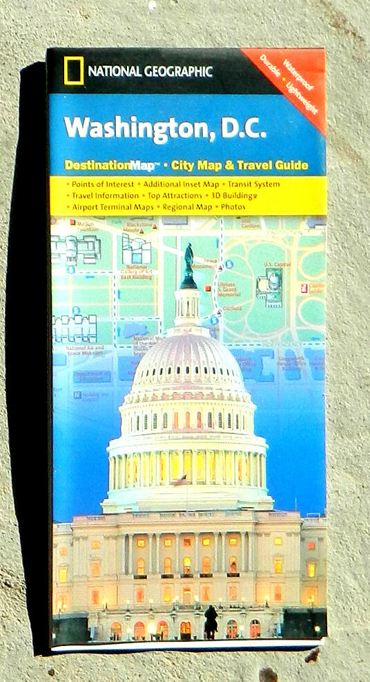
Check the listing for details. National Geographic, Washington, DC DestinationMap (2006, folded guide map). Condition: New. Listed at 3.75 USD. National Geographic, Washington, DC DestinationMap Waterproof, durable map printed on two sides focuses on the most popular tourist sites of central Washington and neighboring Arlington. On one side is the main map covering the National Mall and extending northeast to Georgetown, northwest to Union Station, and south to the Pentagon and Arlington National Cemetery. Landmark buildings and monuments (such as the Capitol, the White House, and the museums of the Smithsonian) are shown in isometric detail, giving the illusion of three dimensions. It shows enough places to keep an intrepid visitor busy for weeks. Details include information centers, Metro stations, Tourmobile routes and stops, parking lots, post offices, police stations, hospitals, points of interest, monuments (including individual statues), theaters, hotels, churches, synagogues, notable buildings, parks, pedestrian areas, and arrows showing the direction of one way streets. This map does not show the entire city, however. On the reverse are several other maps including a regional map showing the main roads of the entire DC area, a schematic map showing the Metro rapid transit system, detail maps of both Washington Dulles International and Ronald Reagan Washington National airports, and a street map of Old Town Alexandria, Virginia. The space in between is packed with information on what to see and how to see it. A street index is also supplied. Scale of main map, 1:11,300 (1 inch = about 0.18 mile). Size: about 25 x 18 inches. Folded. Plastic. Published by National Geographic Maps, 2006. New.Publisher's price: $7.95 Please note that while this item is new, it has been in storage for many years and is not the newest edition.
You may also like